15 people attended the workshop (mostly locals but including a few others from outside the locality with a specific interest in pollution sensing) and the event generated a broad discussion and exploration of not only the local factors affecting London Fields, but also the wider social and cultural perceptions of what it means to measure and map pollution. We'll post some documentation summarising the event's outcomes online soon.
Our next step is to build, with Birkbeck College, our own Feral Robot that can capture sensor data from several types of sensor (Gasoline and Diesel Exhaust, Alcohol, TUolene, Xylene) with location information (GPS) and upload to the Urban Tapestries system. We're hoping to test the prototypes before Xmas and document the project in a small publication (as well as online) by March 2006.
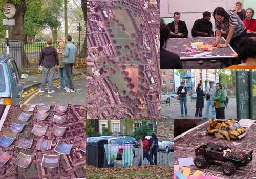
The Feral Robot in the image above is one of Natalie Jeremijenko's built (by Matt Karau) for the Save the Robots festival at The Ark in Dublin during this summer. The map used in the workshop was a high resolution aerial photo of London Fields and surrounding area, kindly provided by Getmapping.com.
Some Links:
London Air
Your Air
DEFRA Air Quality site
Air Quality archive
UCL City Project
Equator: Urban Pollution Monitoring project
Stanza: Sensity Project
Public Air Quality Indicator
European LIFE programme
The Vienna Air Monitoring Network